I am a former teacher/librarian at KCI and I will post items that deal with educational apps or items that teachers or students might use in the classroom. This blog may contain affiliate links that earn me a commission at no extra cost to you. If you would like to follow me click on the blue button below please.
Wouldn't it be nice to go back and spend a day in a city like New York or Chicago or even your own town back in the day. Say like during prohibition and visit a speakeasy. You can do it now, well kind of. Though historical pictures superimposed on current google streetview WhatWasThere allows you to type in an address and see what was there. To see the website click here.
If you used an idea from this website then buy Mr H a gatorade :) Thank you
This is a neat geography guessing game. You are presented with a map location and you have to guess the country out of four picks. After you guess it will show you the correct answer and some information about the country. Note in the top right hand corner you can point the map so north is at the top of the page. You can also zoom in or out. It was 8 for 8 until I got nailed on Tajikistan. I guessed Kazakhstan. Sorry Borat. To play the game click here. Tomorrow is a PD day so have a great long weekend KCI students.
If you teach Geography then mapping activities are probably pretty important. Even though these links are a bit dated, the ideas they represent could be valuable to your teaching and your students. Check them out by clicking here and here.
I posted about Scribble Maps a couple of times in the past. Click here to see. Karrar Haider says "Scribble Maps is a very attractive custom map making service that offers most of its features for free. You can do all the common map editing like calculate distance, add lines, edit overlays, draw, add polygons, add marks and text and easily change the color of all the edits. You can create a map and save/share it without any registration, but registration will let you share maps under your name. The paid version will let you remove the Scribble Maps watermark. To see the website click here.
A couple of Septembers ago I posted about this great site for primary sources. To see the post click here.
There is a search box in the middle of the page but at the top left hand corner there is a drop down menu titled "Explore". You will then have the choice to search by Place, Time Period, Topic, Type of Item, Language, Institution. The other icons at the top are Timelines (which has a WWI timeline), Interactive Maps and lastly Themes.
According to their website, "The Digital Scholarship Lab develops innovative digital humanities projects that contribute to research and teaching at and beyond the University of Richmond. It seeks to reach a wide audience by developing projects that integrate thoughtful interpretation in the humanities and social sciences with innovations in new media."
Just like scribble maps I posted about before (click here) National Geographic MapMaker Interactive is a digital map making tool. To see how to use it watch the following video but watch it in the Youtube site and on the right hand side are plenty of other tutorials. Map Maker Interactive can be found by clicking here.
The National Geographic has a nice article online titled, "Why Your Mental Map Of The World Is (Probably) Wrong". According to their article, "These are some of the most common geographic misconceptions that are both surprising and surprisingly hard to correct." For example, "Most of Africa is north of the equator, though on many mental maps it is mostly in the southern hemisphere directly across the Atlantic from South America." To see the article click here.
Glen Weibe suggests asking these questions:
Based on your mental (or actual) map of the world, answer a few simple questions:
How much of South America is east of Miami, Florida?
How much of Africa is north of the equator?
Which city is further north – Paris, France or Montreal, Canada?
Venice, Italy is located at the same latitude of what major American city?
Which is bigger? The lower 48 United States or Brazil?
Glen suggests having your students use "The True Size Of" website for the last question. I have blogged about this map website in March of 2017. To see that post click here.
He also suggests Bouncy Maps which "connect locations with data. Maps become bigger or smaller to show differences in the data." To see Bouncy Maps, click here.
According to their website, "There is no lack of history resources on the Internet. Historical web sites, blogs, maps, videos, and animations abound. But two things are missing:
A way to tie it all together: text, images, video, audio, historical maps, and animation
A way for anyone to create and share multimedia, animated historical scenarios without having to know programming, graphics, animation, or digital cartography.
History in Motion offers powerful, easy-to-use features so you can create historical scenarios, animate events, share your work with others, and explore history in a way that was never before possible.
If it helps to understand that this was happening here while that was happening there, History in Motion is the tool for you."
To see their website click here. See the video below for an introduction to their website.
According to their website, "Worldmapper is a collection of world maps called cartograms, where territories are re-sized on each map according to the subject of interest." For example of a cartogram, below is one showing births. To see the website click here.
This is a Geography guessing game. You are given three clues that are taken from Wikipedia about a major city in the world. You then click on the globe to select the city. You are then shown how far off you are. To see the site click here.
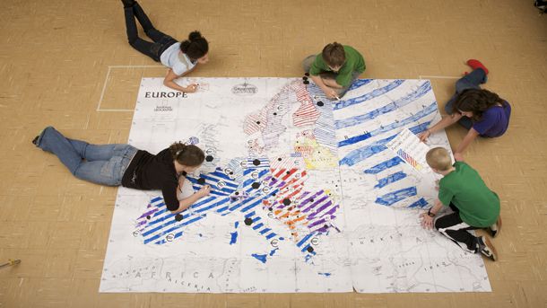
If you would like some large maps for your classroom that you can printout on regular 8x11 paper and jigsaw them together then try National Geographic Mapmaker Kit. According to their website,"Each kit enables the user to download, print, and assemble maps of the world, individual continents, and the United States in a variety of sizes. Mega maps occupy a large wall, or can be used on the floor; projector maps give you some flexibility about sizing; the tabletop map is good for small group work, and the one-page outline maps are perfect for individual work." To see the website click here.
On Saturday my Brother-in-law was over and my son asked him a question about a place he used to live in, namely Belgium. My son was wondering how big Belgium was. Well my brother-in-law looked up the size of Belgium but that only gave him the size in acres or square kilometers. Not very useful for my son. This site will let you do it graphically. See below to see how to select Belgium and Canada. I then moved Belgium over to Southern Ontario as that is where we live. To see the website click here.
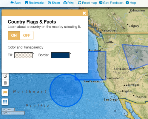
If you need a map making tool, you might want to try MapMaker by National Geographic. To see the website click here. You might need a tutorial on how to use this in your classroom. To see some tutorials click here. There are new interactive tools on MapMaker since these tutorials were made. Namely, Country Facts and Flags, Latitude and Longitude, Custom text, photos and videos.
This site has some maps that would your students understand the Middle East. If your classes are studying current events or history or religion this might be a site you want to look at. To see the website click here.
Half of Canada's population lives where the map is coloured red. Why? Is there a geographical reason for this? If you would like to see some more population divided maps click here. Ask yourself the same question about why half the population is there.